Geospatial Assessment of Urban Road Network Connectivity and Intersection Traffic Performance: A GIS Based Case Study of Court Bazar, Rajshahi, Bangladesh
Abstract
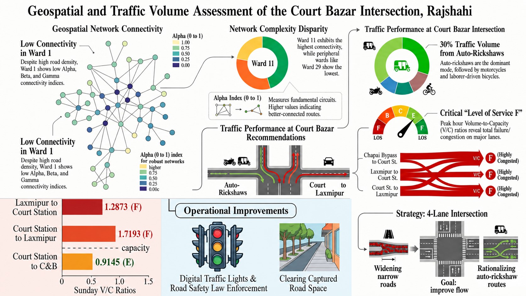
The distinct influence of transportation modes and networks is considered an effective factor in the formation of transportation planning and development. This study addresses that gap for Rajshahi City Corporation (RCC) area by ranking 30 wards through Alpha, Beta, and Gamma connectivity indices together with roads and nodes in a geospatial analysis. A manual counting method is followed for the data collection process during three peak periods across selected survey days at eight intersections of the location where six surveyors completed the data collection procedure. The field-based traffic volume survey evaluates the level of service using the volume/capacity ratio, Peak Hour Factor, and speed-based method. Being a major influential location based on geospatial analysis, the traffic volume survey conducted in the Court Bazaar intersection reveals the traffic patterns and cumulative mode variations throughout the city corporation that outlines the vehicular patterns where auto-rickshaws accounted for the highest volume on major routes, contributing up to 30% of the total traffic volume, followed closely by motorcycles and bicycles for labourer commuting patterns during morning and evening hours. The geospatial analysis identifies variation in traffic composition and traffic flow patterns, highlighting the critical congestion conditions affecting the operational performance of Court Bazar intersection, as four of the intersection’s eight directions reveal level of service F during peak periods. The output provides a clear understanding for transport planners, policy makers, and engineers in developing effective traffic control measures, optimizing signal timings, and enhancing traffic management in the rapidly growing metropolitan cities and similar developing cities in Bangladesh.
Conclusion
The research delved into an in-depth analysis of the Rajshahi Court Station intersection and determined the various outputs of the traffic management, demonstrating the geospatial connectivity indices to justify the study area, and the three crucial methods, Volume/Capacity Ratio, Peak Hour Factor, and Speed-Based methods, assess the quality and traffic dynamics of the study area. The Alpha, Beta, and Gamma indices show connectivity in RCC is unevenly distributed among wards adjacent to major educational and commercial centres. In practical terms, an LOS F rating signifies that the intersection is functioning beyond its intended design capacity where vehicles form queues exceeding the distance that can be discharged within a single signal or gap cycle, travel speeds decline to approximately 5 km/h or less, and delays accumulate rather than diminish throughout the peak period conditions that are likely to be exacerbated as Rajshahi's motorized vehicle and auto-rickshaw fleets continue to expand at an annual rate of 8.5 – 12.6%. So, the leading transport modes- autos and auto-rickshaws highlight to consider in the modification of the traffic management system. These findings suggest that congestion at Court Bazar reflects broader connectivity deficiencies in Ward 1, indicating that intersection-level improvements alone are unlikely to alleviate traffic congestion without complementary network-level interventions. The comprehensive development approach needs to be initiated with methodical interventions for optimization and improvement of LOS to ensure smooth traffic flow and pattern in this node. Future research could extend the TVS across multiple weeks and seasons to evaluate the consistency of the observed Thursday and Sunday traffic patterns, incorporate signal timing and pavement condition variables into the connectivity assessment to develop a composite performance index, and apply the integrated connectivity of TVS framework to other high-density, low-connectivity wards within Rajshahi City Corporation to determine whether the Court Bazar traffic characteristics are representative of the broader urban network. These strategic aims serve as the foundation of Rajshahi transportation development, which provides insights for decision-makers in forming a flawless transport network and vehicular movement at the intersection, ultimately helping the economic growth of the city corporation.